Chicago Storm
-
Posts
18,166 -
Joined
-
Last visited
1 Follower

About Chicago Storm

- Birthday November 18
Recent Profile Visitors
15,534 profile views


-

Spring 2024 Medium/Long Range Discussion
Chicago Storm replied to IWXwx's topic in Lakes/Ohio Valley
I really haven't had time to get into any medium or long range thoughts for quite a while, but... If you're into hyper-active patterns with consistent t'storm/severe t'storm potential and consistently warmer temps, the pattern we are sliding into is for you. One thing to note, though, is that the western/southwestern half of the sub-forum on into the Central US may be favored for the aforementioned. ENS are in agreement on consistent troughing into the PAC NW and potentially deeper into the West Coast, which should allow for a parade of disturbances/storm systems to eject across the Central US. This all begins with the first storm system coming up to end this week, and it may very well continue right on into the first full week of May. -
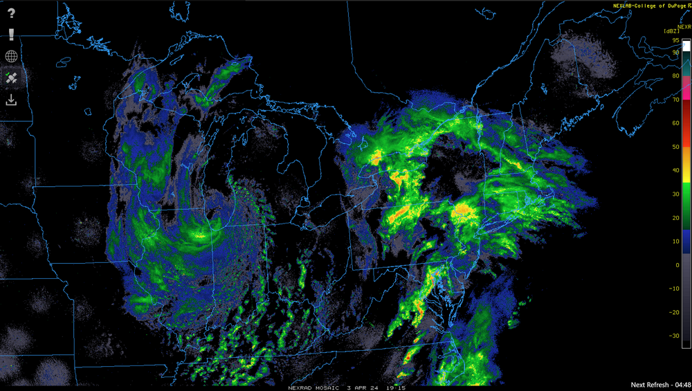
Solid dryline across N and W IL this afternoon. Dew points in the low-mid 50's ahead of it, with mid 20's to low 30's behind it.
-
Spring/Summer '24 Banter and Complaint Thread
Chicago Storm replied to IWXwx's topic in Lakes/Ohio Valley
think that they forgot that high wind warnings exist. -
2024 Short/Medium Range Severe Weather Discussion
Chicago Storm replied to Chicago Storm's topic in Lakes/Ohio Valley
Tomorrow is very uncertain and murky at this point. Many more questions than answers. -
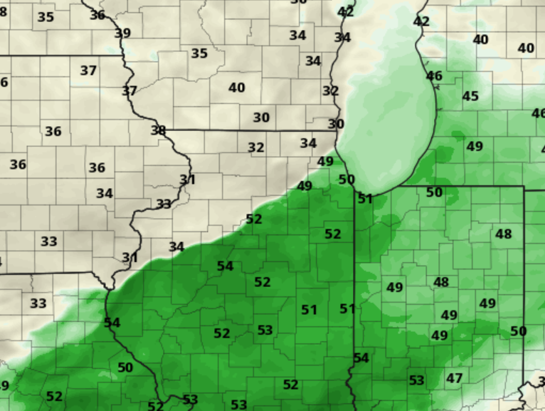
First 80°+ high temp of the year at ORD on Sunday, with a high of 81°.
-
i can't do that long of a flight. otherwise i'd head to australia, where they will have four between 2028-2038. i'll have to wait for the back-to-back one's in 2044 and 2045.
-
they are dead to me because they don't offer bbq sauce. horrible establishment.
-
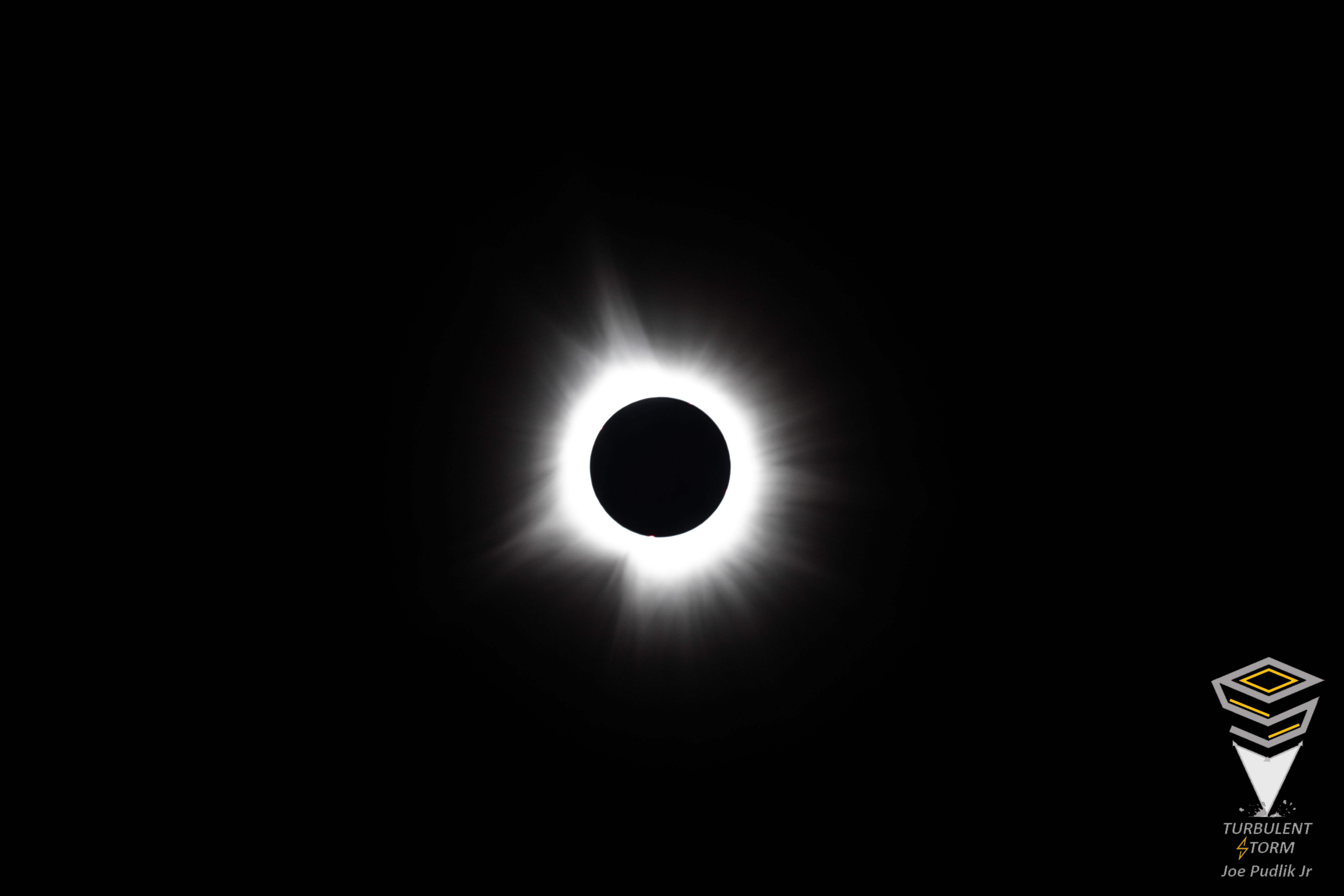
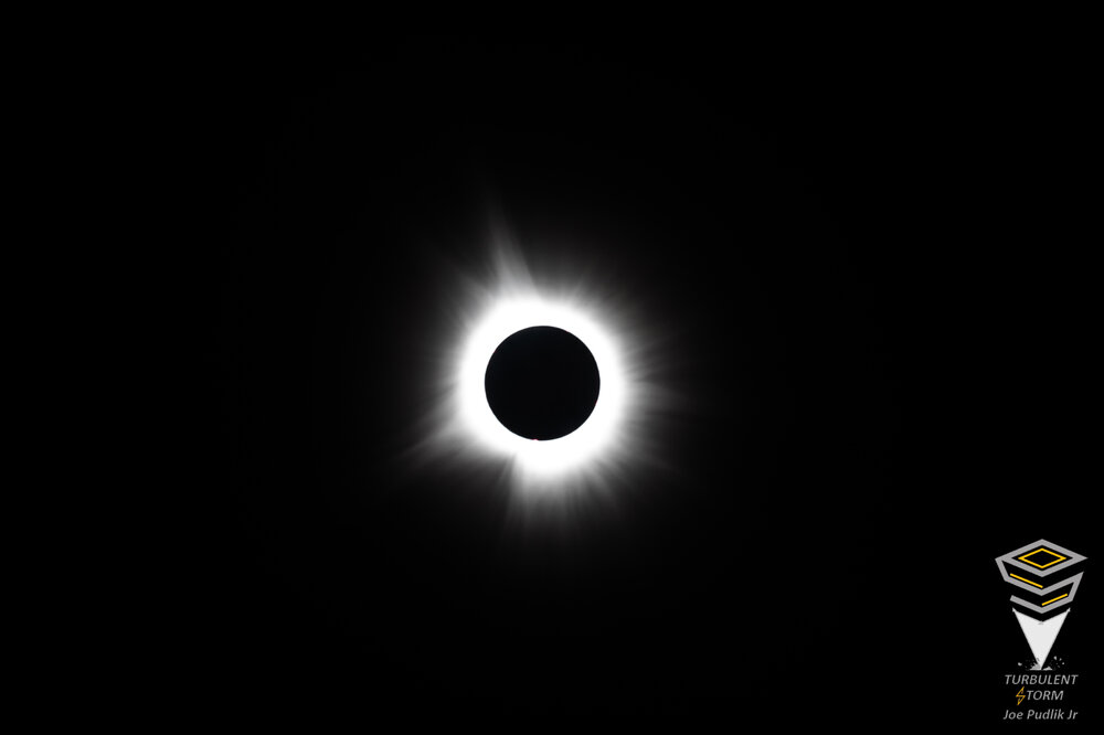
Ended up with great viewing conditions for the eclipse yesterday, as the thicker portion of the high level cirrus cloud deck moved out just in time for totality. As expected, the experience blew out my 15 seconds of totality while riding the edge of the 2017 eclipse just SE of STL. This go-around, having full totality for a solid 4 minutes, was great. I didn't believe it going into it, but it's all true... When totality hits and it goes dark, similar to after sunset on a normal night, things change... Birds got quiet, and nightlife came alive. Instead of having just the western horizon filled with yellow/orange like a normal evening sunset, it was 360° in all directions. In the sky above, it wasn't black and dark like night, but more of a deep/dark navy blue-like shade. Also visible were Jupiter and Venus, as well as eye visible prominence/coronal loop. Looking forward to the next two total eclipse opportunities in 2044 (Montana/Canada) and 2045 (Western/Southern US).
- 121 replies
-
- 15
-

-

-
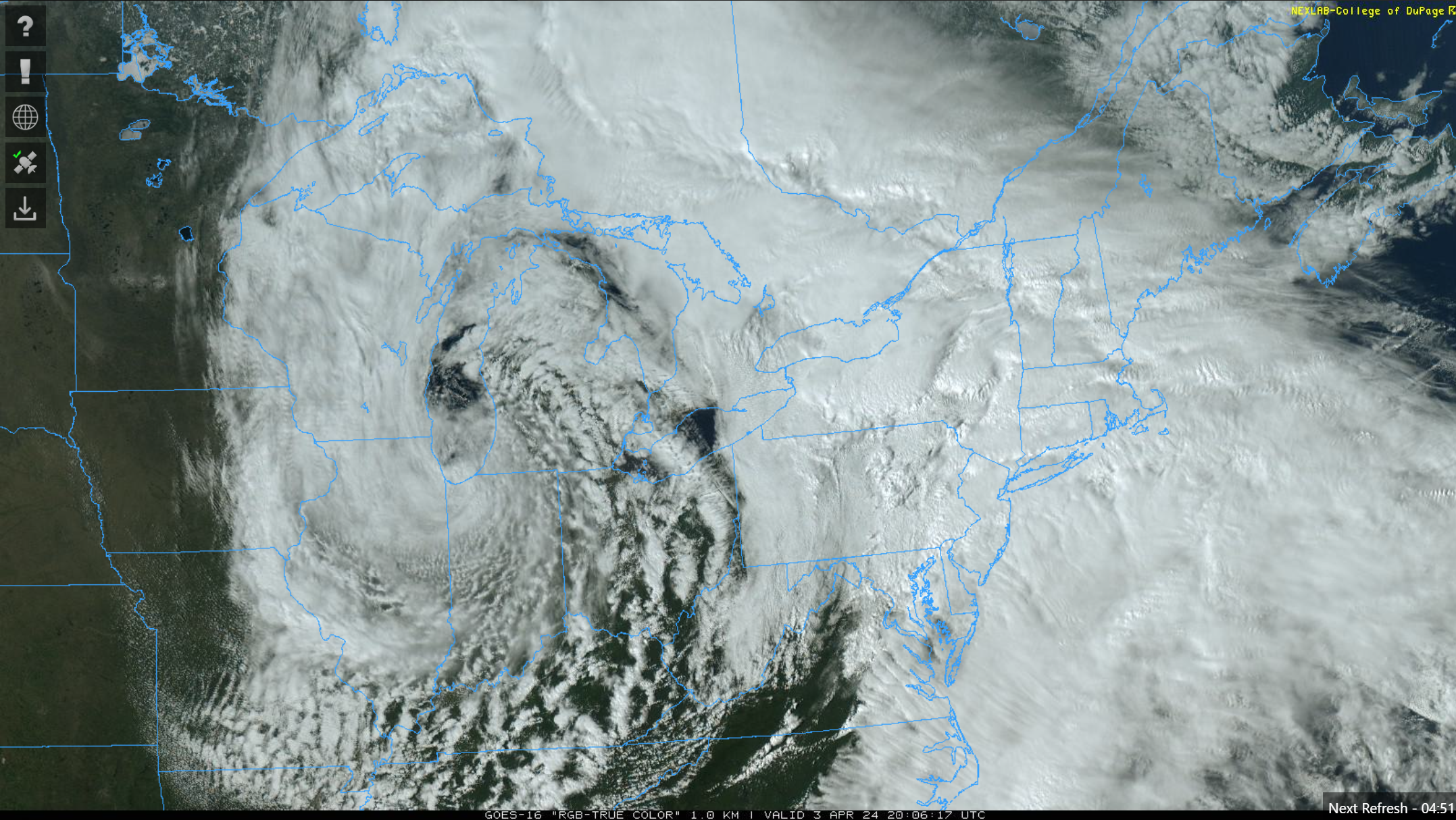
Stationed near Franklin, IN. As expected, have had high clouds this morning and afternoon here, varying between scattered to overcast at ~30,000KFT. Looks like the thicker stuff should be out of the way in time for totality.
-
Have decided to focus on the IN portion of the corridor I had mentioned. Heading down to Indy later today, and will monitor trends tonight/Monday morning to adjust as needed. For that MO/IL/IN/OH corridor, it seems like the better chance to avoid the worst of the cloud situation is there…possibly.
-
I'm honing in on somewhere in the corridor from SE IL, near the IL/IN border, into C IN. Guidance seems to be in best agreement in keeping this corridor out of the expected high clouds, or at least keeping them minimal until after the eclipse. TX/OK/AR/MO all seem to be a lock to have high clouds of higher coverage and significance. While it may still be visible through the higher clouds in some areas in this corridor, the experience will be far from the same. I never really considered the Northeast as a possibility, as it's going to be cooler (Would rather view in quality weather conditions), and there will likely be a higher density of viewers/travelers there due to the proximity to the higher population centers along the East Coast... And plus, I'm just not really interested in heading up that way anyway. In 2017, I was down in Southwestern Illinois, just outside of the STL metro. I was right just inside the range of totality, so I got to experience brief totality and the effects of riding the edge. This go around, I plan on setting up in full/max totality.
-
4/2-4/3 Significant Late-Season Snowstorm (WI/MI)
Chicago Storm replied to Geoboy645's topic in Lakes/Ohio Valley
Had a period of snow in the area Wednesday morning, which then transitioned to RASN by midday and then RA for the afternoon. There was another period of RASN this morning, which transitioned to RA by midday. No measurable snowfall accumulation at ORD with either bout of precip the past two days. -
4/2-4/3 Significant Late-Season Snowstorm (WI/MI)
Chicago Storm replied to Geoboy645's topic in Lakes/Ohio Valley
One of the best looking and most textbook examples of occlusion we have probably seen in this area/region for as long as I can remember...
-
4/2-4/3 Significant Late-Season Snowstorm (WI/MI)
Chicago Storm replied to Geoboy645's topic in Lakes/Ohio Valley
There is sort of an exotic phase with this one. Even a bit of fujiwara effect in the Great Lakes for a time between the northern and southern stream main vort lobes and then again out east later on.
-
4/1-4/2 severe threat (southern portion of subforum)
Chicago Storm replied to largetornado's topic in Lakes/Ohio Valley