downeastnc
-
Posts
9,271 -
Joined
-
Last visited
About downeastnc

- Birthday 05/15/1972
-

January 20-22 “bring the mojo” winter storm threat
downeastnc replied to lilj4425's topic in Southeastern States
Ukie....and this is 10:1 probably do better than that even..... -
January 20-22 “bring the mojo” winter storm threat
downeastnc replied to lilj4425's topic in Southeastern States
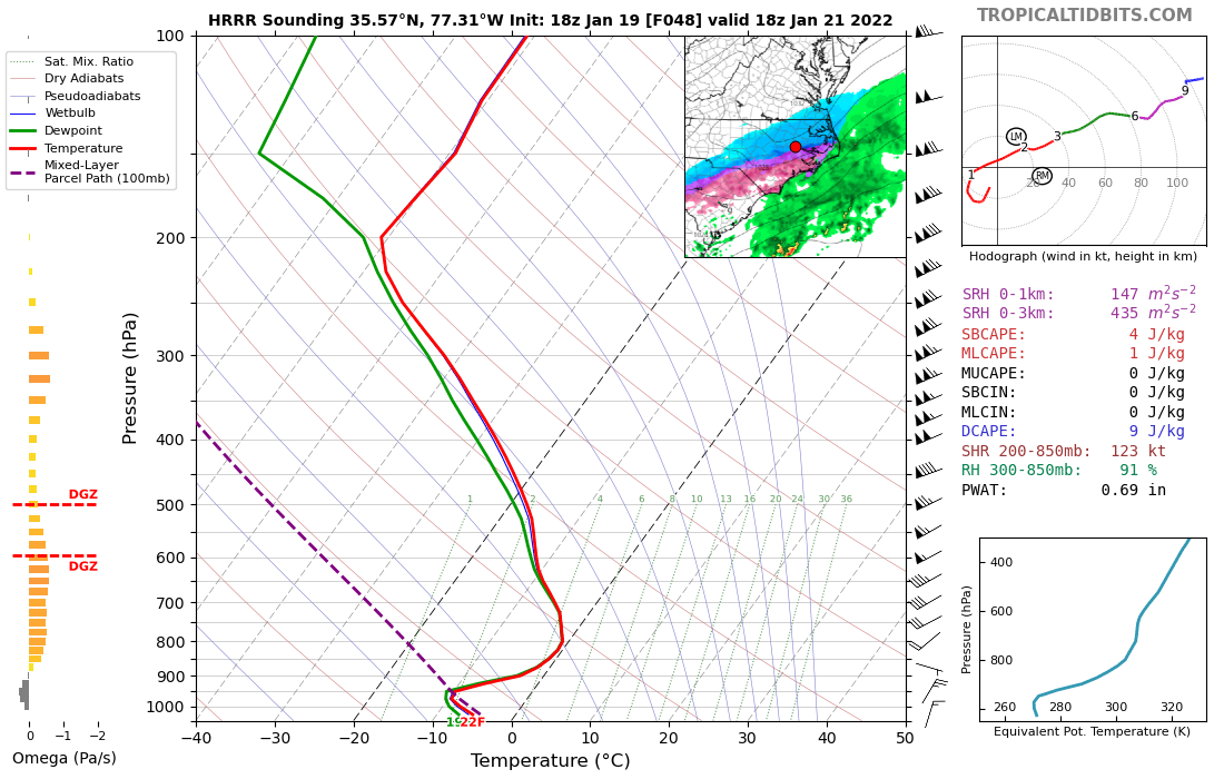
Need to see this slow down just a little bit more, the 6Z GFS spitting out insane ratios for PGV....we get 3" in 3 hrs with .11" QPF....just a few more hrs of that and we would be golden.... assuming of course the GFS has this right....the GFS is so close to this being a much bigger deal. 220122/0500Z 47 36011KT 24.0F SNOW 19:1| 1.1|| 0.00|| 0.00|| 0.057 10:1| 3.6|| 0.00|| 0.00|| 0.37 100| 0| 0 220122/0600Z 48 36010KT 23.8F SNOW 23:1| 1.4|| 0.00|| 0.00|| 0.061 12:1| 5.0|| 0.00|| 0.00|| 0.43 100| 0| 0 ----------------------------------------------+----++-----+-------------++--------------++-------------++-----------+---+--- 220122/0700Z 49 36012KT 23.6F SNOW 13:1| 0.7|| 0.00|| 0.00|| 0.053 12:1| 5.7|| 0.00|| 0.00|| 0.48 100| 0| 0 -
January 20-22 “bring the mojo” winter storm threat
downeastnc replied to lilj4425's topic in Southeastern States
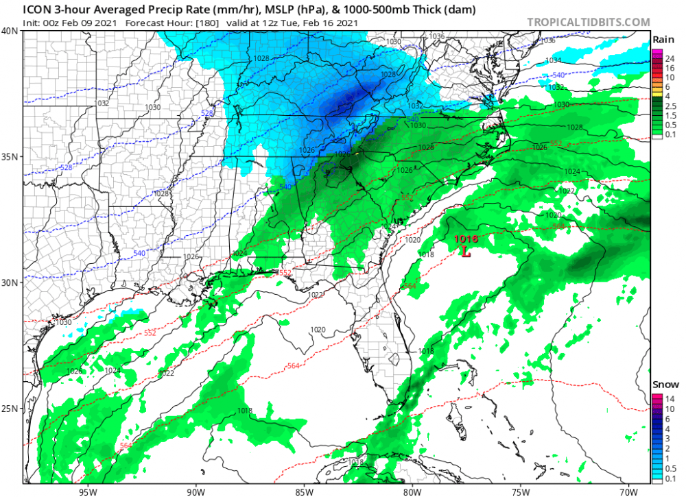
While this sucks for a lot of people this is exactly what we down here in eastern NC like to see in this range.....better cold and not phased and hope for a late bloomer, than watching it amp up and cut and give us rain again....its how we snow big, a lot can still change between now and Friday, and the NAM is all alone right now with this big of a whiff. -
January 20-22 “bring the mojo” winter storm threat
downeastnc replied to lilj4425's topic in Southeastern States
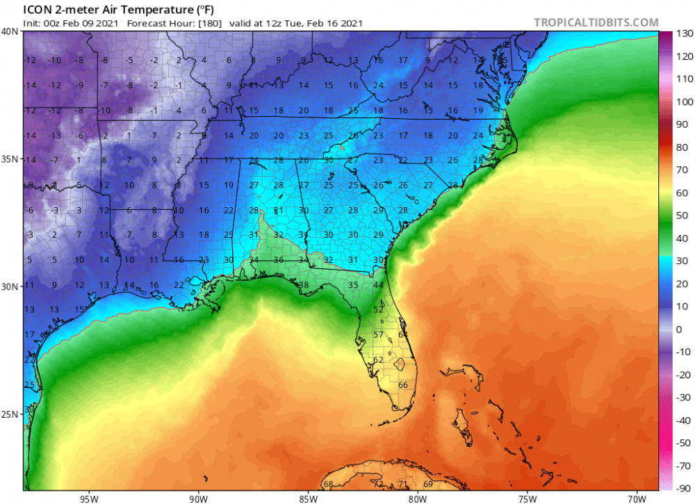
Need that SN/IP line to drift another 50 miles south to really make me feel safe....insane 22 at the surface......
-
The models had Florence turning out well east of Bermuda.....every system is different but yeah models were very wrong with Florence even up to landfall there were fairly significant changes.....
-
This chaser looks to be trying to drive into the eye from Houma
-
-
-
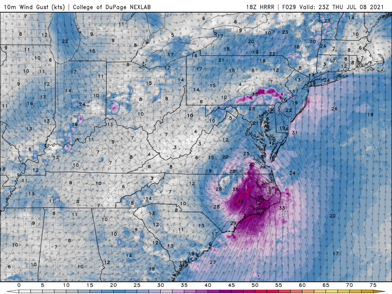
HRRR bullish on winds. usually I take these maps with a grain of salt but with the high offshore packing the gradient and dry air working in around the S and SE side who knows...maybe some 40-50 mph gust are possible for 3-4 hrs tomorrow....
-
Yeah might get some gust into the low 40's certainly nothing to extreme...nice that it seems to peak between 4-9 tomorrow afternoon and not 12-4 am like usual.
-
Well then
-
70/63 at PGV.....gonna be interesting to see how it plays out today.....had some filtered sun a hr ago back to overcast.....sat looks like some more filtered sun possible in a hr or two around peak heating.....
-
Looks like EF2-3 type damage.....some fairly new homes look to be wiped to the foundation almost....
-
This is pretty darn good agreement....


-
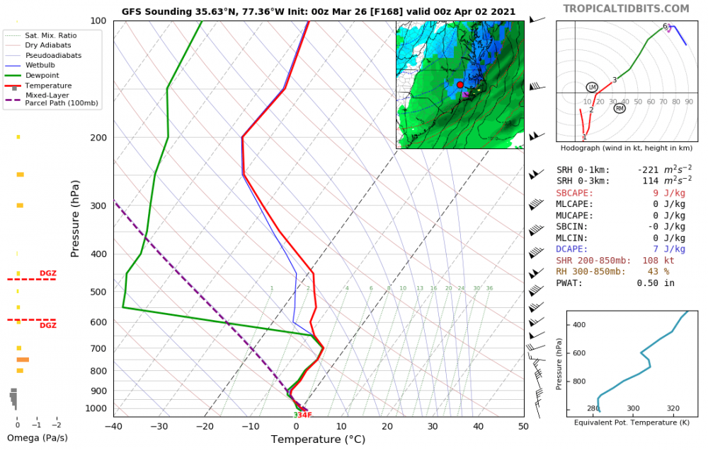
Yeah this is a insane panel.....with that low strength and placement you wouldnt think the warm nose is that strong.....its showing 23/24 IMBY with the snow/rain line slam back in the mts.....