shaggy
-
Posts
7,428 -
Joined
-
Last visited
About shaggy

-
Might be one of the biggest pressure drops in history. Anyone have the stats on that?
-
The ATL has had its fair share of majors as well
-
Dang https://www.tropicaltidbits.com/sat/satlooper.php?region=15W&product=vis_swir
-
Guam and Rota dodged a bullet as blohaven has exploded after passing by the islands. https://www.tropicaltidbits.com/sat/satlooper.php?region=15W&product=ir
-
Should see it drop fast as the winds rotate to the SW. Couldn't have come quick enough as they were approaching major flood stage downtown with a 6.69 foot level......major starts at 7 feet
-
Been gusting into the 40s for 5 or 6 hours with maybe a few touching 50.
-
Need that center to tuck a little west under that convection
-
Hi res are all more cape fear to lookout globals more over bogue banks to obx
-
Seems to be 2 camps. Hi res models are much stronger and show a stronger capture with the west turn before releasing it north. All show a potential hurricane. Globals don't show as much of a capture or as strong of a system
-
I believe Gustav 2004 also quickly developed as it moved onshore SC. Nothing suggest anything similar here though
-
In this situation the hybrid or ST will likely bring bigger impacts to larger areas of the coast versus a true TD/TS. Gfs has a decent area of gale force winds up the southeast coast far away from the center
-
Icon coming in the furthest east at 12 with a weak low with the strongest winds displaced far to the north. Certainly not a fully tropical look to it was
-
Had a few flirting with the OBX

-
0z Hafs-A is coming in south of 18z by a good but. At 18z it was just about to hit 23N and now at the same time frame its just about to hit 22N so almost 1 whole degrees.......if my tired eyes are reading it right
-
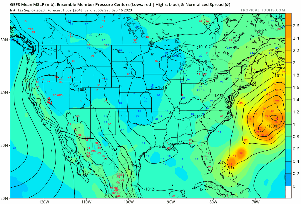
Gefs spread really opened up again threatening the NE even more again. Also did I see the hafs-A jump almost an entire degree south at 0z out to 75hrs