

ThompNickSon
-
Posts
64 -
Joined
-
Last visited
About ThompNickSon

-
Elevated Mixed Layers in Severe Weather
ThompNickSon commented on ThompNickSon's article in General Analyses & Forecasts
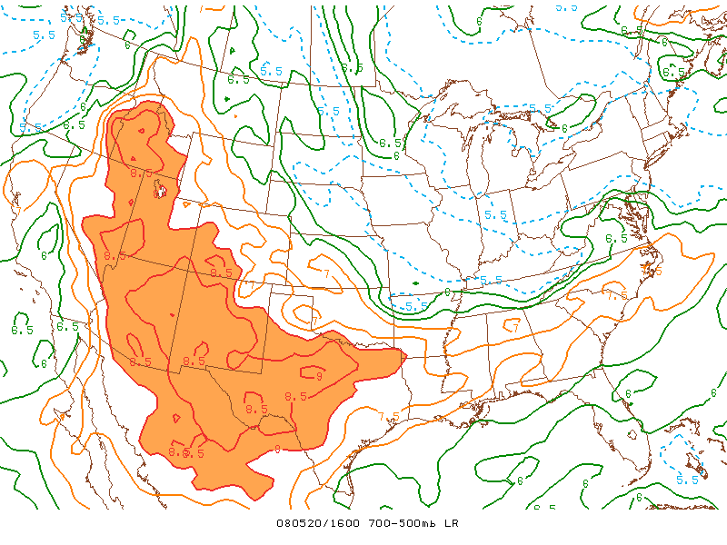
To be honest, I am not sure how this topic got to be featured, but I am very grateful to AmericanWX for the tremendous illustration of an EML that introduces the topic. My goal was to have a discussion that survived particular events, and the discussion exceeded my wildest hopes. Lots of very smart people kicked in lots of valuable information. One of the most valuable bits was the link to the Storms Prediction Centers experimental page, which is an amazing wonderland of graphs and maps. See http://www.spc.noaa.gov/exper/mesoanalysis/new/viewsector.php?sector=19#, for example. Perhaps some readers could shed light on the resources here? The role of EML's in tornadoes is still a puzzle to me. Notice that while the late April outbreak in the south seemed to have a lot to do with dry lines and eml's, the recent mother's day outbreak did not, at least so far as I could see. I would love to see that paradox discussed. My thanks to everybody who participated .. and to any others who will pitch in. N -
Elevated Mixed Layers in Severe Weather
ThompNickSon posted a article in General Analyses & Forecasts
 EML's, which are packets of desert air that originate in the intermountain west, are often invoked to explain severe weather as far away from the Rockies as New England. For several months I have been puzzling how such dry (heavy, dense) air could maintain its coherence and altitude while passing the two thousand miles from ABQ to BDL. To put the question in the least technical way possible: Why wouldn't it fall down? Looking at SKEW-T's I see that such parcels of air are fairly common in the East, manifesting themselves as a sharp rightward movement of the temperature line, and a very sharp, leftward movement of the dewpoint line at some point above the surface, with the two lines reconverging at higher altitudes to form a sort of tent-like pattern. I would love to get a discussion going on EML's and/or skewT's in general. Any takers? Let's discuss it here.