usedtobe
-
Posts
8,793 -
Joined
-
Last visited
About usedtobe

Recent Profile Visitors
6,656 profile views


-
It is drier. Not sure that means a lot.
-

Jan 19th Snow on Snow: the this always works until it doesn't thread
usedtobe replied to psuhoffman's topic in Mid Atlantic
Yes and gives me 3". Now I'll take walk so I don't see the GFS to disappoint me.- 850 replies
-
- 26
-

-

-
Jan 15-16 Storm Threat Thread: Do we finally win or get Saltburned?
usedtobe replied to H2O's topic in Mid Atlantic
Thanks. I do look in. At least we have two possible events to track. You've got a lot of pros and good enthusiasts so I'm not sure what I could add.- 449 replies
-
- 15
-
-

-
- jinx
- kiss of death
- (and 3 more)
-
Jan 15-16 Storm Threat Thread: Do we finally win or get Saltburned?
usedtobe replied to H2O's topic in Mid Atlantic
I broke the accumulations down to 6 and 12 hr intervals and stormvista gave nothing. Here's it's 24 hr amounts. If it snows that lightly we'd be lucky to get more than a coating. Graphic is courtesy of StormVista.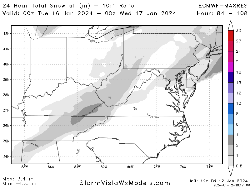
- 449 replies
-
- 3
-

-
- jinx
- kiss of death
- (and 3 more)
-
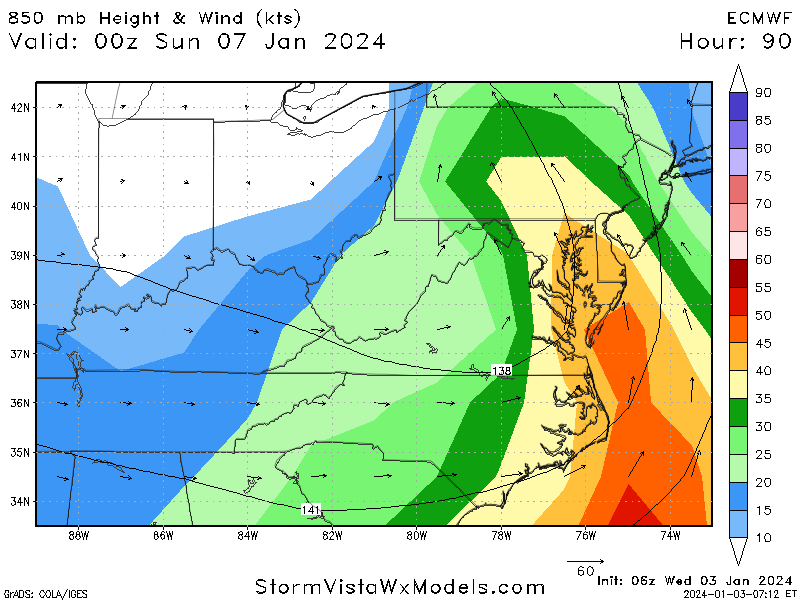
But the Euro has had that feature for days. Here's a 90hr forecast valid a 7PM Saturday.
-
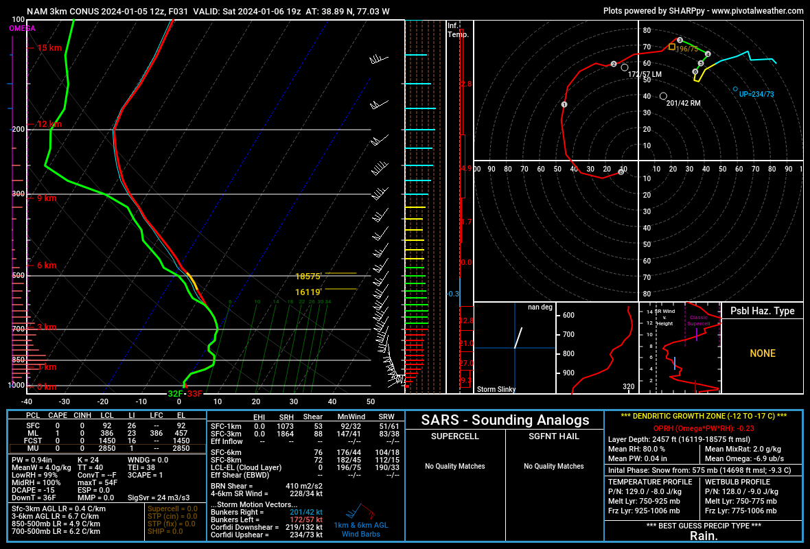
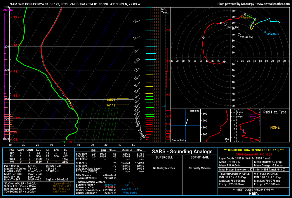
The killer for most of us is the roaring southerly winds at around 5000 ft. Here's a forecast sounding for DC at 19Z or 2 PM Note that where the warm layer is and has DC at around 4C. that's also where the winds are southerly at 50kts or stronger.
-
Personally, in these really marginal temp event, I use the snow depth product. It's more conservative with amounts which is a good think. If it's really cold other snow maps are probably preferable. The GFS snowdepth product from the 18Z run.
-
Jan Medium/Long Range Disco: Winter is coming
usedtobe replied to stormtracker's topic in Mid Atlantic
Interesting that 1964-1969 was a snowy period. -
I think your last two sentences are correct. We need the heavier precipitation and associated vertical motion to keep temps cold enough for snow. Of course not for me.
-
3.13" 2 miles north of Dunkirk in Calvert County.
- 240 replies
-
- 12
-
-
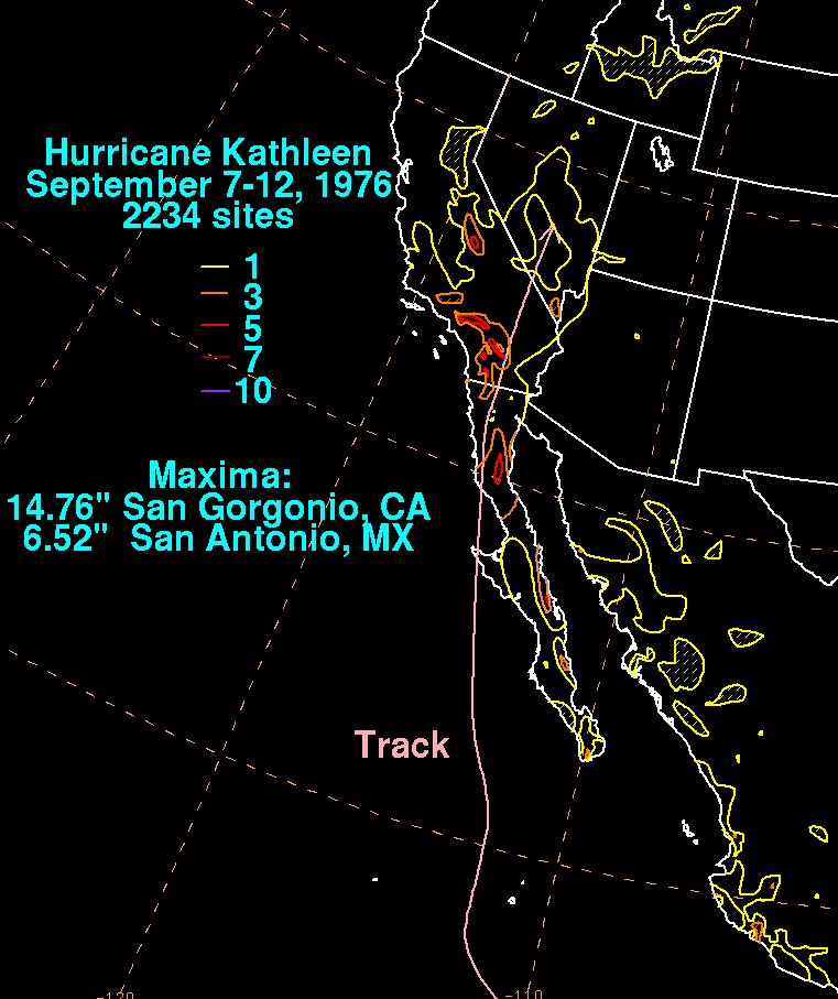
Kathleen in 1976 had almost an identical track. It cause lots of flooding and pretty much wiped out one town.

- 427 replies
-
- 11
-
-
-
I think that pretty much what the 06Z GFS was forecasting. The GFS definitely has problems. It's been running hot or at least that has been my perception. Still 96 or 97 with dewpoints in the 70s is nasty.
-
March Medium/Long Range Thread: The Empire Strikes Back
usedtobe replied to stormtracker's topic in Mid Atlantic
-
Late February will be rocking. February Long range Discussion thread
usedtobe replied to Ji's topic in Mid Atlantic
Looks bad. -
Getting my minutes of snow.