wxmx
-
Posts
3,684 -
Joined
-
Last visited
About wxmx

- Birthday 12/29/1973
-
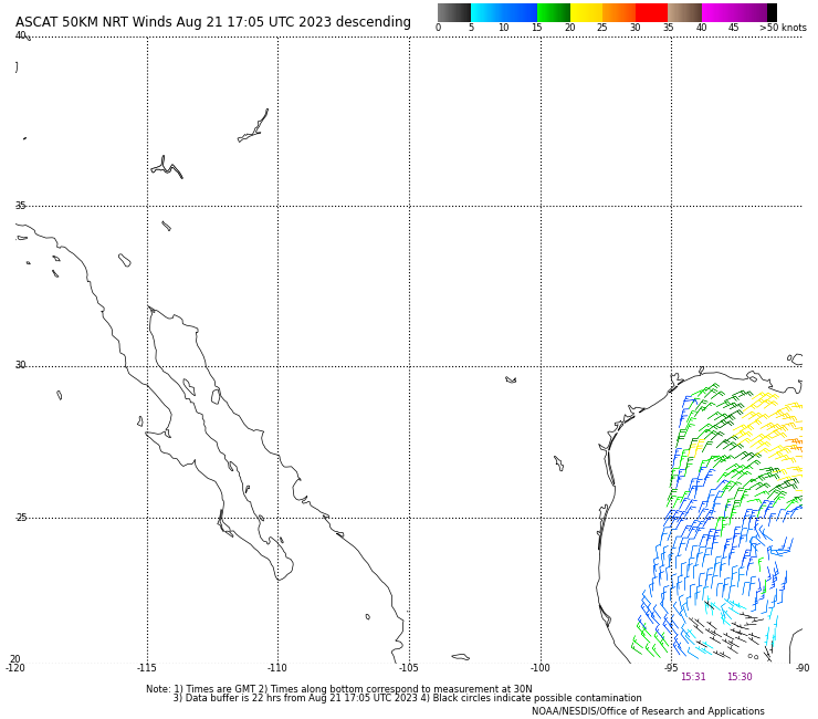
Looks like a well defined LLC
-
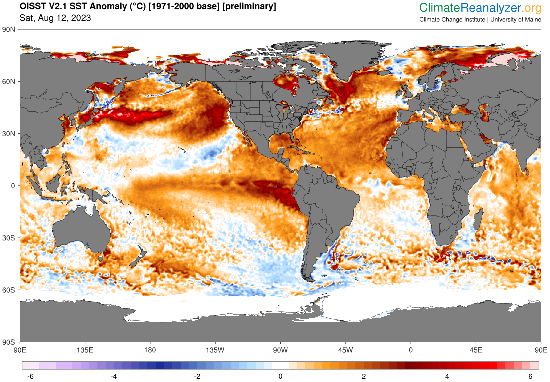
Report: Another Year of Record Heat for the Oceans
wxmx replied to donsutherland1's topic in Climate Change
El Niño & +AMO ... but the lack of significant below normal areas is quite something.
-
Report: Another Year of Record Heat for the Oceans
wxmx replied to donsutherland1's topic in Climate Change
Source
-
Looking at the models/ensembles, the stronger/earlier development, the farther right it goes, looks like a good example of beta drift.
-
Officially a cat 2 - 85 kts hurricane, with 967mb central pressure.
-
968mb extrapolated, 85 kts SFMR. It will probably be upgraded to cat 2
-
Visible imagery. Sunset are the beer googles of hurricanes.
-
Hopefully before sunset. Would be a very photogenic image of Grace
-
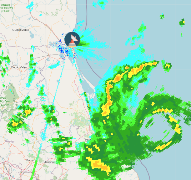
Shear has abated some, to around 10-15 kts. Looks like it gained a bit of latitude during the convective explosion, but not much. Now looks like Tecolutla may be ground zero. If trends continue we can speculate on a major at landfall.
-
Diana 1990 and Gert 1993 are possible analogs to strength and landfall location. They both caused record flooding in the area.
-
Yeah, no cyclone is match to the Sierra Madre. The bigger and meaner, the more dramatic the fall. Only thing is all it's juice is squeezed out, causing mudslides and extensive flooding.
-
Yes, now I have this image in my mind

-
And right on cue. The last 12 hours up to landfall were the ones that we expected Grace would intensify more aggressively and we are near that threshold. We needed a hurricane that looked like one, and it's taking that look now.
-
Briefly yesterday https://www.nhc.noaa.gov/archive/2021/al07/al072021.discus.022.shtml?