vortex95
-
Posts
1,001 -
Joined
-
Last visited
About vortex95

Recent Profile Visitors
5,858 profile views


-
See attachment for PDS bliz and ice storms. Goes into effect 10/1/26. I thought the NWS was trying to *reduce* the number of types of watch/warning products b/c there were too many. For instance, Blizzard Watch was removed several years ago. I am not a fan of PDS b/c it diminishes those events not labeled such that can be just as impactful. It's like Tornado Emergency. First, all tornadoes are emergency situations that require immediate action. Second, hearing "only" a tornado warning can be perceived as not as urgent to many. So a PDS blizzard or ice storm, same thing. And what exactly constitutes a PDS really? It is not always due to the meteorological severity or hard numbers. If a large population is impacted, does that mean a PDS is warranted. It's like saying a smaller population is less important than a larger one. Meteorological intensity and impact are two different things and not necessary correlated. I can just see PDS being overused from factors that have nothing to w/ the wx event itself. And it gives an excuse for the media and all the hype masters out there to ratchet things up even more, which promotes warning apathy further. The idea of PDS may look good on paper and in theory, but how it is handled in a practical sense in reality is an entirely different ballgame, and the way wx is handled these days in itself as if all inclement wx is "extreme," "unusual," and "not supposed to happen?" The ordinary is turned into the extraordinary far too often. What's next, a PDS for a hurricane landfall? Dense fog? Dust storm? More warning is not necessary better. There comes a point of diminishing returns. pds.pdf
-
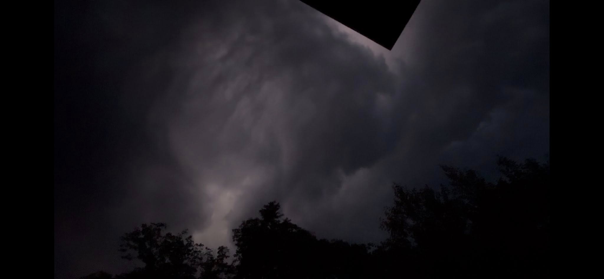
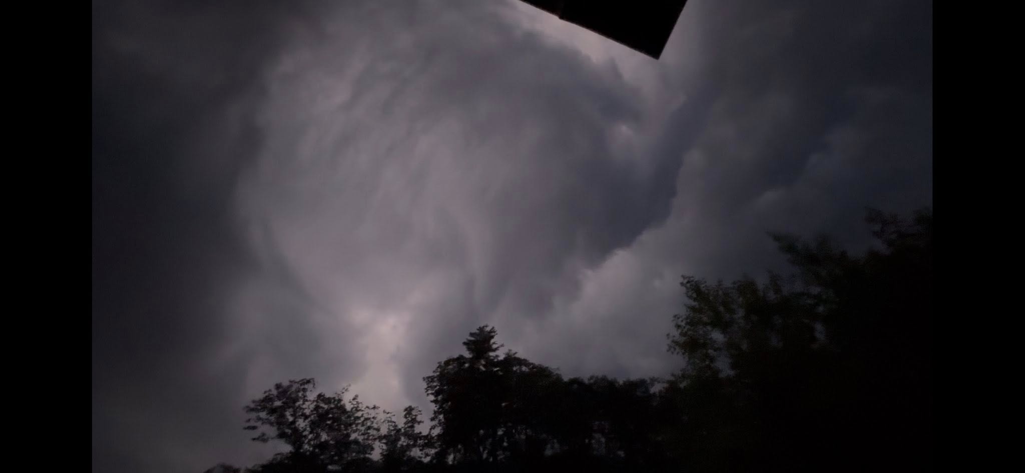
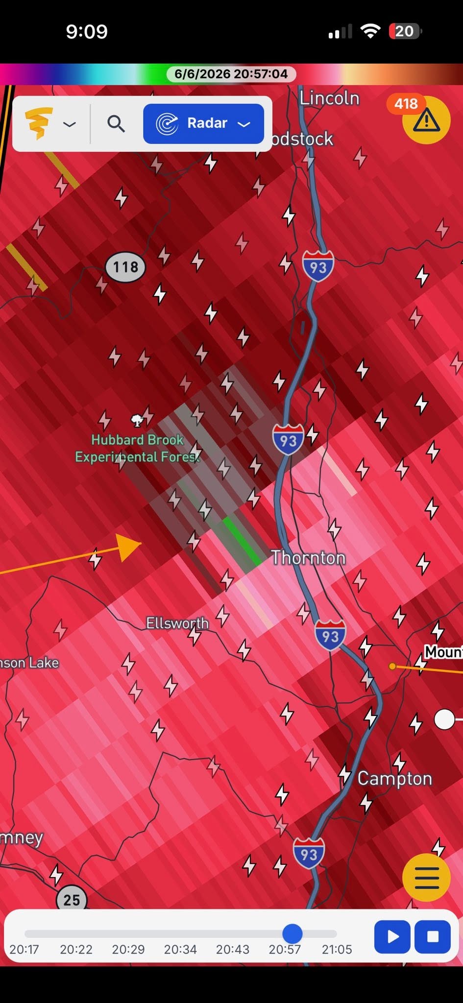
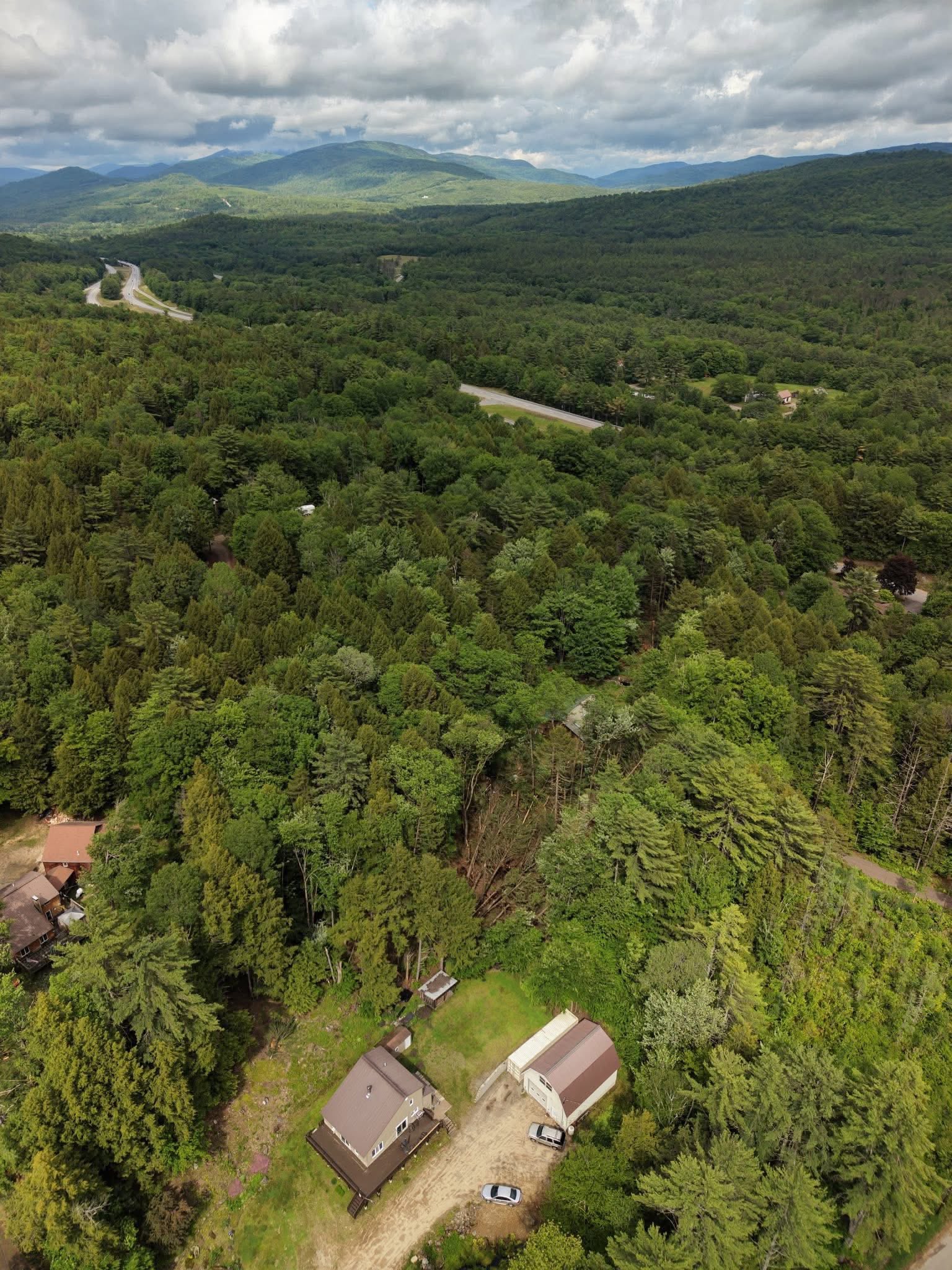
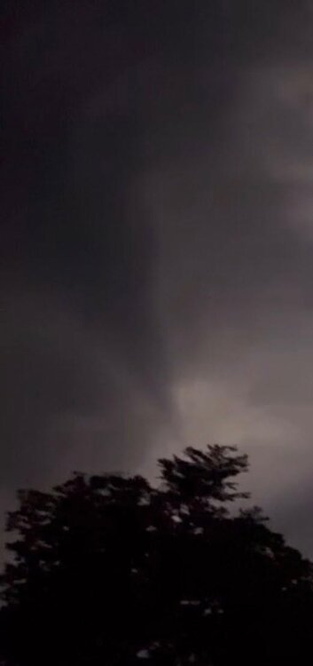
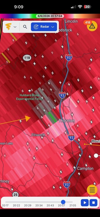
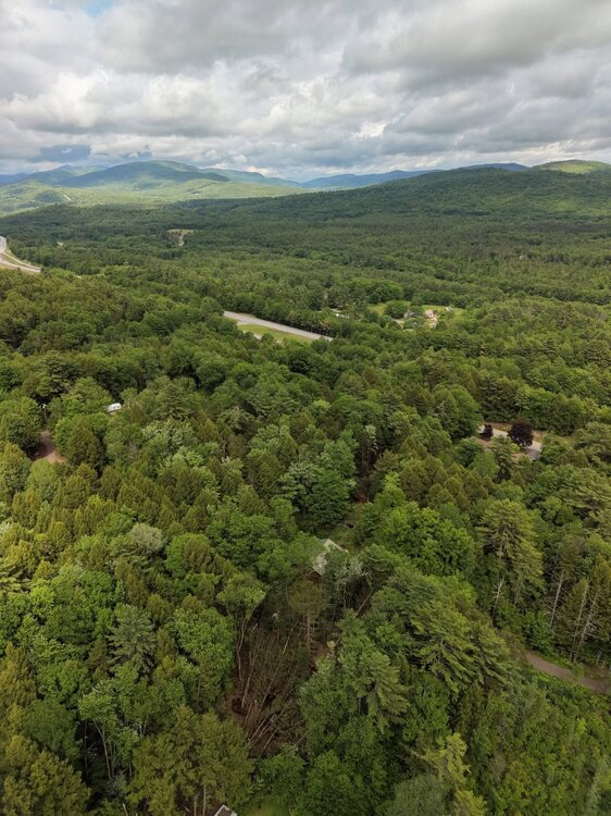
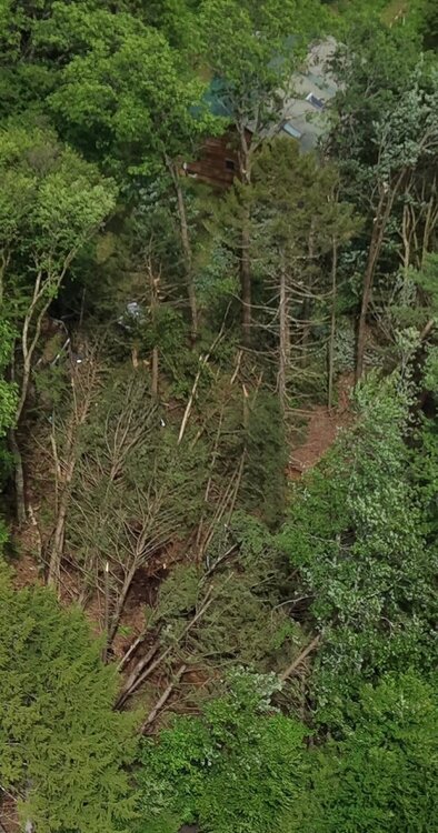
Thornton NH 852 pm 6/6. Probable Scott spinner. Video link and video stills attached. I think there are two funnels! One in the center of the video at the start, and then one off to the left at the end! https://www.facebook.com/TheWizardline/videos/1009799924785673/ This looks like a classic brief spin-up tor on the S side of a comma head associated w/ a bow echo. These are more common than once thought, and sometimes you can get a bunch clustered from the comma head. The cloud structure is not classic back edge of the storm w/ a clear wall cloud. This is b/c the comma head makes it more chaotic/messy from a visual standpoint. It is not raining that hard near the funnel as the visibility is good, and that would make sense given the lower echoes in the rear of the comma head. The drone pix shows very localized tree damage. Too small and sharp for a microburst. Yes, the trees are all laying in one direction but that can be misleading. The bow echo was moving E 40-50 mph, so a weak tor moving that fast can easily have it winds on one side of the circulation negated to a point no tree damage occurs, and the other side enhanced, so trees would all fall in the same direction. And we know from observations in the field now, brief tornadoes like this are much more common than we once thought. So many spotters, chasers, cameras, and now drones make detection much more likely. This is about 65 mi from GYX WSR-88D and that would make it about 5000 ft at VEL1. A little high to catch the best low-level rotation, so I bet there was better below 5000 ft. I sent all this to WFO GYX.


-

-
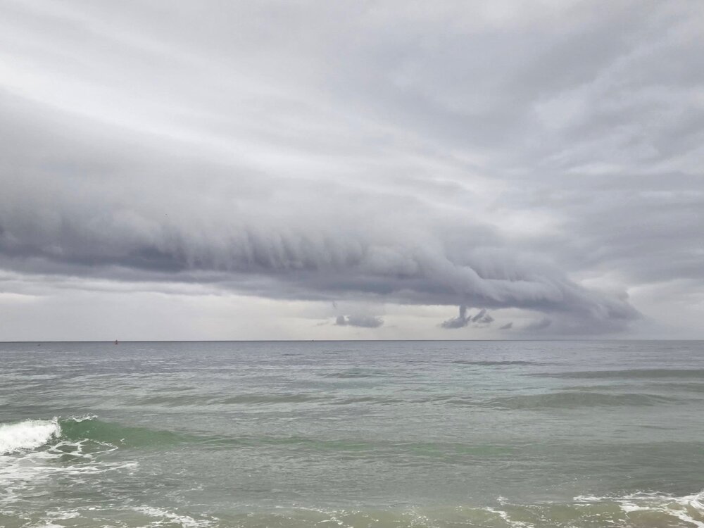
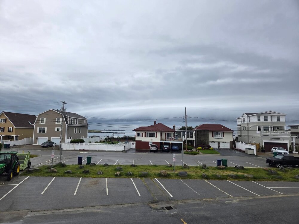
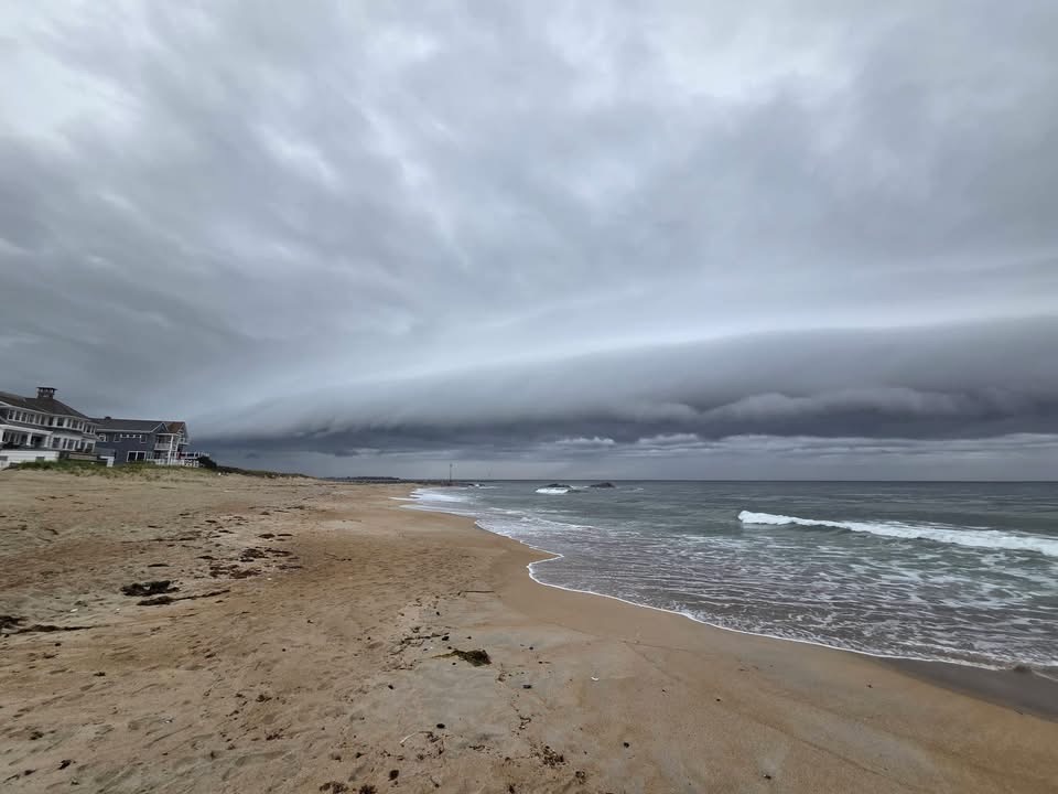
Hampton Beach not 20 min ago. Photos courtesy of Rich Hamel. Even when no tstms exist, the mesoscale "Hampton Effect" as I have called it, comes through!
-
-
EDIT: Oops! I did not realize the graphic was adjusted/edited for the additional fake categories! Yes, what you noted about dew points and descriptors, it used to be that way, but enter the age of excess labeling and hype! Below 60 is comfortable, 60-65 moderately humid, 65-70 muggy, and 70 and above oppressive/tropical for the vast majority of the population. Sticky, muggy, and humid mean the same thing. And 60-65 is not muggy per se. Tropical is 70 and above.
-
SPC took out general tstms for SNE 13z update? I don't think so. Plenty of sun, adequate CAPE, and cold temps aloft as a solid s/w trof swings through. HRRR and RRFS clearly show cells ern MA and the S Coast. 12z RRFS gets carried away it seems Buzzards Bay area showing a li'l 2.78" max but the 06z had a .70" max in the same area. Meso models all along have shown decent potential S Coast today, so no reason to think it will not happen. Also, storms dropping from the N often over-perform in SNE and it's how CC and the S Coast do their best.
-
BOOTYLICIOUS?
-
Livin' in a C-I-T-Y!
-
Same supercell that was in VT earlier, just weakened a bit and now has ramped up, EIR shows a solid overshooting top.
-
Two thing CoastalWx will go on and on about, Animal House and Rocky IV!
-
"THEY TOOK THE BAR, WHOLE F'IN BAR!!!"
-
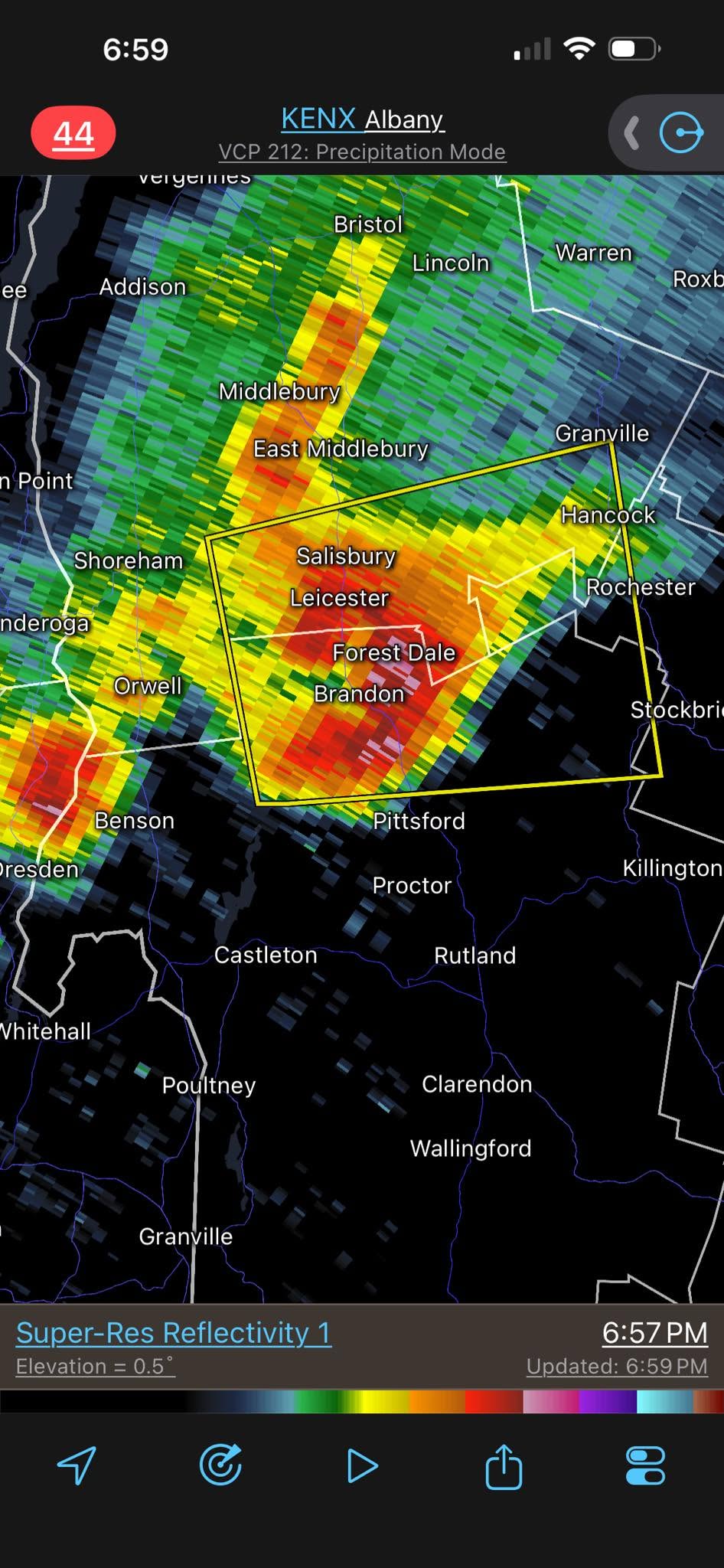
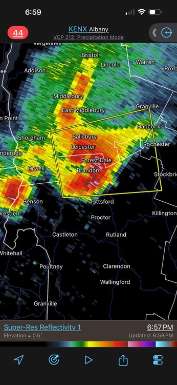
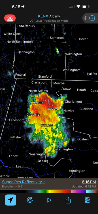
Should of stayed in VT!!! RRFS was correct w/ discrete cell near RUT.
-
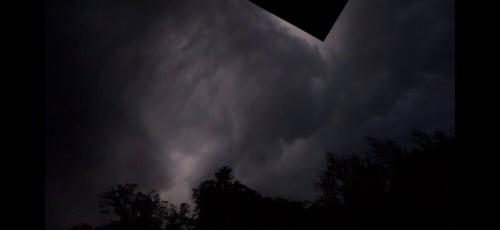
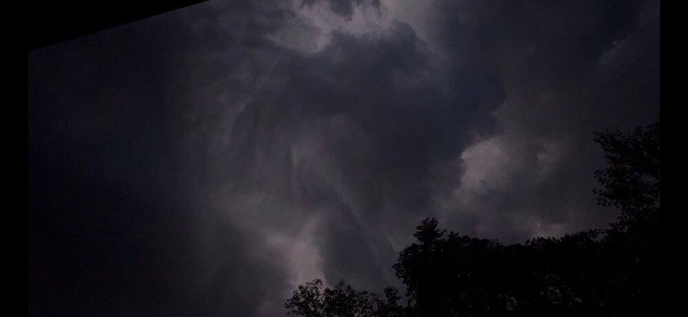
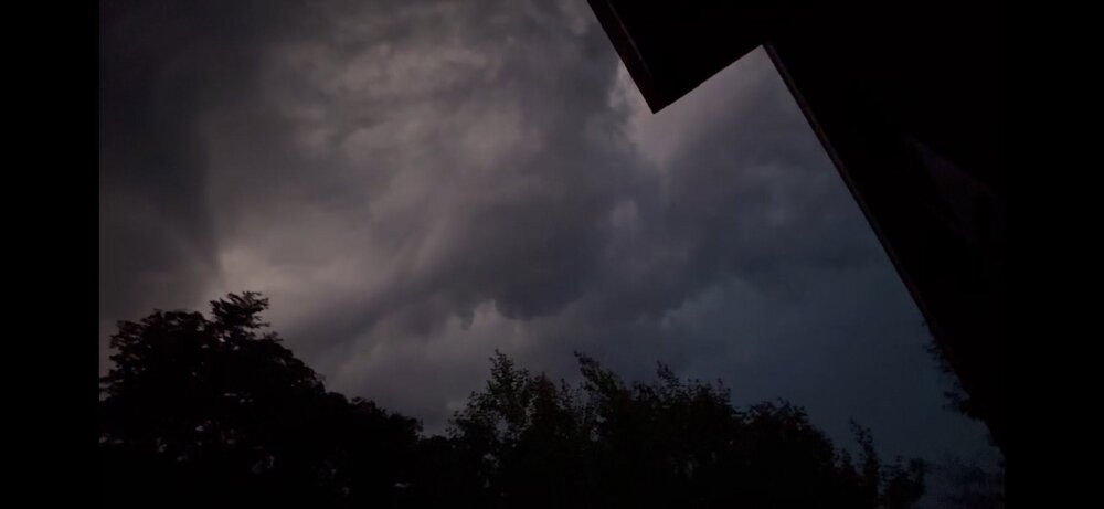
Left-moving supercell? Where is wxwiz?!
-
That large of an area to the E of a lead warning? The eastern edge of the warning, it is going to be almost an hour before anything occurs When ppl get a svr tstm warning, and say, 30 min goes by, and nothing has happened yet, that I would argue promotes apathy, and ppl will start to stand down/go back to what they are doing. Many ppl are only willing to take so much time out of the day for short-fused, convective-related warnings like this. A longer lead time is not always better. There comes a point of diminishing returns.
- 442 replies
-
- 2
-

-
- severe
- thunderstorms
- (and 7 more)