Sock Puppet Posted October 30, 2012 Share Posted October 30, 2012 Winds have calmed down here considerably. Expecting to pick up again with the bands moving in Link to comment Share on other sites More sharing options...
Chaser25973 Posted October 30, 2012 Share Posted October 30, 2012 http://public-blog.nrc-gateway.gov/2012/10/29/nrc-continues-to-monitor-sandy-including-alert-at-oyster-creek-plant/ The NRC continues to monitor impacts of Sandy on nuclear power plants in the Northeastern U.S., including an Alert declared at the Oyster Creek nuclear power plant in New Jersey. The plant, currently in a regularly scheduled outage, declared the Alert at approximately 8:45 p.m. EDT due to water exceeding certain high water level criteria in the plant’s water intake structure. Link to comment Share on other sites More sharing options...
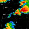
RCNYILWX Posted October 30, 2012 Share Posted October 30, 2012 Link to comment Share on other sites More sharing options...
csnavywx Posted October 30, 2012 Share Posted October 30, 2012 Wind pennant at LGA on last station plot. Sustained at 57mph. Edit: EWR gusting to 65kt (75mph)! Link to comment Share on other sites More sharing options...
NYCSuburbs Posted October 30, 2012 Share Posted October 30, 2012 I can't even imagine what the damage from this is going to amount to in the end. Based on all of these reports I have a bad feeling this might approach Katrina-type damage. People have been saying for a long time NYC was overdue for a significant hurricane. And this is it. Link to comment Share on other sites More sharing options...
WeatherNC Posted October 30, 2012 Share Posted October 30, 2012 WoW, L2 feed from OKX iPad via scope 1042pm... Link to comment Share on other sites More sharing options...
andyhb Posted October 30, 2012 Share Posted October 30, 2012 14.31? Unbelievable. Link to comment Share on other sites More sharing options...
Entropy Posted October 30, 2012 Share Posted October 30, 2012 Simply amazing, cirrus shield reaches all the way to the Iowa/Illinois border. Incredible size. To get a better idea of the immensity of Sandy, consider the following: a buoy just northeast of Cleveland was reporting sustained winds of 55 mph, and gusts to 67 mph, shortly after 10 PM. This thing is massive. http://www.ndbc.noaa.gov/station_page.php?station=cndo1 Link to comment Share on other sites More sharing options...
kevbo81 Posted October 30, 2012 Share Posted October 30, 2012 ABC 7 lost power. on generator power Link to comment Share on other sites More sharing options...
Jefflaw77 Posted October 30, 2012 Share Posted October 30, 2012 14.31? Unbelievable. What does this mean?? Also can some whO has some knowledge about where the storm is etc care to comment?? I'm hanging in by a thread here w/ my iPhone.. Link to comment Share on other sites More sharing options...
eyewall Posted October 30, 2012 Share Posted October 30, 2012 Major flood in Lindenhurst Link to comment Share on other sites More sharing options...
yoda Posted October 30, 2012 Share Posted October 30, 2012 FDNY scanner: Power in NYU Tisch Hospital failed, nurses in pediatric ICU manually bagging patients on ventilators, emergency evacuation. Link to comment Share on other sites More sharing options...
blizznd Posted October 30, 2012 Share Posted October 30, 2012 As a NWS met out here in North Dakota I want to pass on to all the posters great work in giving out such great info. I have been checking this out all night and just in amazement of the events. Dan Link to comment Share on other sites More sharing options...
IntenseBlizzard2014 Posted October 30, 2012 Share Posted October 30, 2012 What does this mean?? Also can some whO has some knowledge about where the storm is etc care to comment?? I'm hanging in by a thread here w/ my iPhone.. It means more water rise for Lower Manhattan. Link to comment Share on other sites More sharing options...
WeatherNC Posted October 30, 2012 Share Posted October 30, 2012 What does this mean?? Also can some whO has some knowledge about where the storm is etc care to comment?? I'm hanging in by a thread here w/ my iPhone.. Will write most if not all record books, hammer down for a couple hours in NYC, N NJ proper, backside about to come through... Link to comment Share on other sites More sharing options...
Derecho! Posted October 30, 2012 Share Posted October 30, 2012 Claims that Coney Island Hospital is on fire and FDNY can't get there. http://www.sheepsheadbites.com/2012/10/breaking-coney-island-hopstial-is-on-fire/?utm_source=dlvr.it&utm_medium=twitter Link to comment Share on other sites More sharing options...
Springerjen2001 Posted October 30, 2012 Share Posted October 30, 2012 Coney Island Hospital on fire...surrounded by 3-4 feet of water. http://www.sheepsheadbites.com/2012/10/breaking-coney-island-hopstial-is-on-fire/ Link to comment Share on other sites More sharing options...
Tyler Penland Posted October 30, 2012 Share Posted October 30, 2012 To get a better idea of the immensity of Sandy, consider the following: a buoy just northeast of Cleveland was reporting sustained winds of 55 mph, and gusts to 67 mph, shortly after 10 PM. This thing is massive. http://www.ndbc.noaa...p?station=cndo1 We are getting easily 40-50MPH gusts here in NE GA. Winds have picked up significantly in the past hour. My thoughts and prayers go out to all of you! Link to comment Share on other sites More sharing options...
Geos Posted October 30, 2012 Share Posted October 30, 2012 Rooftop rescues going on in Sayreville by Raritan River! Link to comment Share on other sites More sharing options...
RCNYILWX Posted October 30, 2012 Share Posted October 30, 2012 What does this mean?? Also can some whO has some knowledge about where the storm is etc care to comment?? I'm hanging in by a thread here w/ my iPhone.. With high tide over an hour away on the LI Sound, that's a bad sign. I'm thinking despite the more southeasterly winds now, the water rising so quick might force more water back toward the East River and prolong the flooding threat there. Link to comment Share on other sites More sharing options...
CooL Posted October 30, 2012 Share Posted October 30, 2012 Lost power about 30mins ago. Not expecting to get it back for a while Link to comment Share on other sites More sharing options...
Derecho! Posted October 30, 2012 Share Posted October 30, 2012 With high tide over an hour away on the LI Sound, that's a bad sign. I'm thinking despite the more southeasterly winds now, the water rising so quick might force more water back toward the East River and prolong the flooding threat there. Storm Tides are actually beginning to drop throughout LI Sound - looks like they won't come close to the Upton Forecast. Connecticut TV has reporters out where the water is falling. Link to comment Share on other sites More sharing options...
Thrasher Fan Posted October 30, 2012 Share Posted October 30, 2012 breakingstorm City officials confirm that an evacuation is underway at New York University Langone Medical Center - @eyewitnessnyc 10/29/12 11:10 PM Claims that Coney Island Hospital is on fire and FDNY can't get there. http://www.sheepshea..._medium=twitter FDNY #FDNY units are on scene at Coney Island Hospital. No confirmed fire or reports of injuries at this time. 10/29/12 11:14 PM Link to comment Share on other sites More sharing options...
RCNYILWX Posted October 30, 2012 Share Posted October 30, 2012 Storm Tides are actually beginning to drop throughout LI Sound - looks like they won't come close to the Upton Forecast. Connecticut TV has reporters out where the water is falling. Looks like they did start to drop, so that's good news. Interesting because from reading the tide tables, it looked like the time of high tide was around 12am edt. Link to comment Share on other sites More sharing options...
Rjay Posted October 30, 2012 Share Posted October 30, 2012 Sry if this was mentioned..684,000 of 1.1 mil LIPA customers with out power on LI. Link to comment Share on other sites More sharing options...
sctvman Posted October 30, 2012 Share Posted October 30, 2012 Friend on Upper East Side says there was an electrical fire in my building, the smoke has funneled into her apartment. The NYFD/PD has asked 4 buildings to leave, taped them off and are not letting people back into their apartments until deemed safe even though none of them have power. The storm still has not hit there. She had to abandon my apartment, taken what she could and her friend came to the rescue. Link to comment Share on other sites More sharing options...
BxEngine Posted October 30, 2012 Share Posted October 30, 2012 2 reported fatalities in Pearl River after tree into house caused partial collapse. Link to comment Share on other sites More sharing options...
Chris L Posted October 30, 2012 Share Posted October 30, 2012 This is worse than Irene, Floyd, Gloria for some locations for sure. Incredible. Link to comment Share on other sites More sharing options...
WeatherNC Posted October 30, 2012 Share Posted October 30, 2012 DIX valid 1125, couple minutes, l2 feed. Link to comment Share on other sites More sharing options...
Geos Posted October 30, 2012 Share Posted October 30, 2012 TWC: 100s of people being evacuated from Greenwich, CT. - people who did not heed the evacuation warning! Link to comment Share on other sites More sharing options...

Recommended Posts
Archived
This topic is now archived and is closed to further replies.