MnWeatherman Posted June 13, 2012 Share Posted June 13, 2012 Thursday keeps looking better for severe weather across MN and the vicinity. GFS and NAM both have a consistent boundary position by evening and this system appears to have a negative tilt, which should give ample amounts of shear for the initiation zone. LCLs are also looking promising. Climatology, MN is in peak tornado season now. Link to comment Share on other sites More sharing options...
Minnesota Meso Posted June 13, 2012 Share Posted June 13, 2012 Thursday keeps looking better for severe weather across MN and the vicinity. GFS and NAM both have a consistent boundary position by evening and this system appears to have a negative tilt, which should give ample amounts of shear for the initiation zone. LCLs are also looking promising. Climatology, MN is in peak tornado season now. I agree, if the dews verify, than this looks like the best set up yet this year for MN. Don't have time to post any maps, but tonight I will look to see how the models did with the dews for today. Look like warm front convection will be on going through the day tomorrow, possibly aided by the outflows, later in day it looks to interact with a weak to moderate cold front IMO. Link to comment Share on other sites More sharing options...
Chinook Posted June 13, 2012 Share Posted June 13, 2012 For what it's worth, the SPC significant tornado ingredients is up to 30 north of the Twin Cities tomorrow. Link to comment Share on other sites More sharing options...
Minnesota Meso Posted June 14, 2012 Share Posted June 14, 2012 Checking the observed dew points today against what the ECMWF was forecasting with the 13/12z run, the pocket of 60 dews in SD verified nicely, it is forecasting 65 dews in MN for tomorrow, I don't see any reason why that won't verify as well. I think 65 will work nicely with the this set up, 70's may have allowed to much cin to build up. Link to comment Share on other sites More sharing options...
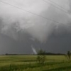
MnWeatherman Posted June 14, 2012 Author Share Posted June 14, 2012 Supercell dominating in SE SD; funnels have been reported with it. Link to comment Share on other sites More sharing options...
thewxmann Posted June 14, 2012 Share Posted June 14, 2012 Checking the observed dew points today against what the ECMWF was forecasting with the 13/12z run, the pocket of 60 dews in SD verified nicely, it is forecasting 65 dews in MN for tomorrow, I don't see any reason why that won't verify as well. I think 65 will work nicely with the this set up, 70's may have allowed to much cin to build up. If anything, higher dewpoints means less CINH... Link to comment Share on other sites More sharing options...
andyhb Posted June 14, 2012 Share Posted June 14, 2012 If anything, higher dewpoints means less CINH... Took the words out of my mouth. Link to comment Share on other sites More sharing options...
MnWeatherman Posted June 14, 2012 Author Share Posted June 14, 2012 This might get interesting... Link to comment Share on other sites More sharing options...
Jim Martin Posted June 14, 2012 Share Posted June 14, 2012 All three of these soundings around the Twin Cities all are indicating winds backed at the surface very nicely. As mentioned in the previous post, things could get very interesting later today. Link to comment Share on other sites More sharing options...
Ian Posted June 14, 2012 Share Posted June 14, 2012 looks like the morning convection is going to be a problem for the higher risk area. i'd say the risk is probably considerably lower than earlier outlooks but we'll see if they change at all. Link to comment Share on other sites More sharing options...
Ian Posted June 14, 2012 Share Posted June 14, 2012 I guess SPC disagrees Link to comment Share on other sites More sharing options...
jojo762 Posted June 14, 2012 Share Posted June 14, 2012 looks like the morning convection is going to be a problem for the higher risk area. i'd say the risk is probably considerably lower than earlier outlooks but we'll see if they change at all. I was about to say the samething, but I guess the SPC thinks the Morning Convection won't affect the Afternoon/Evening Convection... Link to comment Share on other sites More sharing options...
Buckeye05 Posted June 14, 2012 Share Posted June 14, 2012 Every time I see a big rain sheild like that overspread a risk area in the morning, it results in a big minimalization of the risk or a bust 90% of the time (Nebraksa April 14, Dayton metro March 2, Manitoba just recently.) However, NWS in Twin Cities is thinking otherwise for today. "REGARDLESS OF WHAT HAPPENS THIS MORNING...WIDESPREAD SHOWERS AND THUNDERSTORMS ARE EXPECTED TO DEVELOP ACROSS WESTERN MN THIS AFTERNOON OUT AHEAD OF THE COLD FRONT. WARM FRONT SHOULD MAKE RAPID PROGRESS TO THE NORTH TODAY AND WILL LIKELY EXTENDED FROM NORTH CENTRAL MN INTO WEST CENTRAL BY 21Z THIS AFTERNOON. THE NEW SPC DAY1 HAS A 10% TORNADO PROBABILITY IN EAST CENTRAL MN AND WEST CENTRAL WI. CAN`T REALLY ARGUE WITH THIS GIVEN THE 0-1KM SRH AND BULK SHEAR OFF THE NAM AND RAP...RIGHT AROUND 100-200 M2/S2 AND 20KTS RESPECTIVELY AROUND 21Z THIS AFTERNOON IN EASTERN MN. THE MOST FAVORABLE LOW LEVEL WIND FIELD LIFTS NORTH LATE THIS MORNING TOWARDS DULUTH. FURTHERMORE...THE TOP 15 DATES FROM THE CIPS WARM SEASON ANALOG OFF THE 00Z NAM FROM LAST NIGHT DOES CONCENTRATE THE TORNADO REPORTS IN EAST CENTRAL MN...WITH THE WIND AND HAIL COVERING A MUCH LARGER AREA." Link to comment Share on other sites More sharing options...
MnWeatherman Posted June 14, 2012 Author Share Posted June 14, 2012 looks like the morning convection is going to be a problem for the higher risk area. i'd say the risk is probably considerably lower than earlier outlooks but we'll see if they change at all. I also agree, currently sticking with willmar, right now, for positioning. Expansive anvil clouds to my east have barely moved in the last hour and a half, also a severe thunderstorms are developing behind the main mini squall, making more of a cloud deck. Cap is stronger that anticipated, which should halt initiation till mid afternoon or later. Link to comment Share on other sites More sharing options...
Ian Posted June 14, 2012 Share Posted June 14, 2012 Delayed but not denied. Maybe they slept thru 1630. Link to comment Share on other sites More sharing options...
Ian Posted June 14, 2012 Share Posted June 14, 2012 it's fun to watch timmer spin marginal days. i like how he sees a strong tornado threat in the southern plains today. Link to comment Share on other sites More sharing options...
Buckeye05 Posted June 14, 2012 Share Posted June 14, 2012 it's fun to watch timmer spin marginal days. i like how he sees a strong tornado threat in the southern plains today. Haha, yeah. Though I have to say it didn't look that marginal last night and early this morning. Link to comment Share on other sites More sharing options...
Ian Posted June 14, 2012 Share Posted June 14, 2012 Haha, yeah. Though I have to say it didn't look that marginal last night and early this morning. in the southern plains it did.. i mean there's extreme instability but not much shear and it's mainly cold frontal. Link to comment Share on other sites More sharing options...
SmokeEater Posted June 14, 2012 Share Posted June 14, 2012 it's fun to watch timmer spin marginal days. i like how he sees a strong tornado threat in the southern plains today. It's how he makes his money now. If he tells the people that pay for his stream, that it's a marginal day, less will pay for it. Then again, he's always made every little threat seem like the apocolypse. Link to comment Share on other sites More sharing options...
NaoPos Posted June 14, 2012 Share Posted June 14, 2012 It's how he makes his money now. If he tells the people that pay for his stream, that it's a marginal day, less will pay for it. Then again, he's always made every little threat seem like the apocolypse. MmmhmmmmCOUGH COUGHmmmhmmm !!! Jk buddy! That's the world of private mets these days. Link to comment Share on other sites More sharing options...
brettjrob Posted June 14, 2012 Share Posted June 14, 2012 It's how he makes his money now. If he tells the people that pay for his stream, that it's a marginal day, less will pay for it. Then again, he's always made every little threat seem like the apocolypse. I usually defend him, but this year it's reached a threshold where I'll have to admit he's playing to his audience. I do think he's an eternal optimist regardless of audience, and that explains a lot of his rhetoric, but some of these recent instances almost beg for another explanation. Either that, or a year like 2012 breaks you down and warps your perception of reality when you base your life around chasing. I should know, except I have more of a bipolar reaction than an always-grasping-at-straws one. Losing the financial backing of the TV deal this year also puts them in a position of having either to take new risks (e.g., premium stream, using social media aggressively to get advertising hits) or give up the chase-everything mentality they've adopted the past few years. Link to comment Share on other sites More sharing options...
baroclinic_instability Posted June 14, 2012 Share Posted June 14, 2012 NAM the last 1.5 days was right on with the event across MN...with quite a bit of early DMC along diffuse boundaries across the WAA regime...and a much faster Pacific front. Most of the best storms are not in the best kinematic environment...also too much junk-vection early. It is not often the NAM beats all other guidance, including hi-res and the ECMWF. Link to comment Share on other sites More sharing options...
baroclinic_instability Posted June 14, 2012 Share Posted June 14, 2012 I usually defend him, but this year it's reached a threshold where I'll have to admit he's playing to his audience. I do think he's an eternal optimist regardless of audience, and that explains a lot of his rhetoric, but some of these recent instances almost beg for another explanation. Either that, or a year like 2012 breaks you down and warps your perception of reality when you base your life around chasing. I should know, except I have more of a bipolar reaction than an always-grasping-at-straws one. Losing the financial backing of the TV deal this year also puts them in a position of having either to take new risks (e.g., premium stream, using social media aggressively to get advertising hits) or give up the chase-everything mentality they've adopted the past few years. You bring up some good points, and I think it is likely a combination of both. Eternal optimism without success, at some point, will have to warp ones mind to reality. He certainly has seen his fair share of success this year, but he has seen a lot of busts where he was calling outbreaks. One thing that keeps me from believing he is doing it solely for business is he will often call for big tornado days when he is not chasing them. He did it for the east coast event a couple of weeks ago, for instance. Link to comment Share on other sites More sharing options...
Ian Posted June 14, 2012 Share Posted June 14, 2012 I usually defend him, but this year it's reached a threshold where I'll have to admit he's playing to his audience. I do think he's an eternal optimist regardless of audience, and that explains a lot of his rhetoric, but some of these recent instances almost beg for another explanation. Either that, or a year like 2012 breaks you down and warps your perception of reality when you base your life around chasing. I should know, except I have more of a bipolar reaction than an always-grasping-at-straws one. Losing the financial backing of the TV deal this year also puts them in a position of having either to take new risks (e.g., premium stream, using social media aggressively to get advertising hits) or give up the chase-everything mentality they've adopted the past few years. I always say he (or his team) is clearly very good but I do wonder if he's hurting himself among those who actually matter -- not that he had a ton of fans in the scientific community to start it seems. Obviously his fanbase is made up of some really stupid people so lying to them is not a big deal. Link to comment Share on other sites More sharing options...
Ian Posted June 14, 2012 Share Posted June 14, 2012 You bring up some good points, and I think it is likely a combination of both. Eternal optimism without success, at some point, will have to warp ones mind to reality. He certainly has seen his fair share of success this year, but he has seen a lot of busts where he was calling outbreaks. One thing that keeps me from believing he is doing it solely for business is he will often call for big tornado days when he is not chasing them. He did it for the east coast event a couple of weeks ago, for instance. His business is severe weather more than chasing on his own at this pt (or it will be).. especially if they ever launch their site from the sounds of it. Him hyping any threat seems like it fits into the pattern pretty well. Link to comment Share on other sites More sharing options...
baroclinic_instability Posted June 14, 2012 Share Posted June 14, 2012 His business is severe weather more than chasing on his own at this pt (or it will be).. especially if they ever launch their site from the sounds of it. Him hyping any threat seems like it fits into the pattern pretty well. Yeah that is true. Credibility and the ability to forecast severe is important for his fan base. I guess I personally do not know what he plans to do with this site/business he is starting. Link to comment Share on other sites More sharing options...
baroclinic_instability Posted June 14, 2012 Share Posted June 14, 2012 His business is severe weather more than chasing on his own at this pt (or it will be).. especially if they ever launch their site from the sounds of it. Him hyping any threat seems like it fits into the pattern pretty well. Sadly this is the model for many these days, hypecasting. Why bother trying to be right and thorough when all you need to do is pander to the lowest common denominator while making decent money doing it. Hypecasting, as a whole, hurts the credibility of the meteorological community. They vary in quality from one to another (i.e., some are actually really good mets with quite a bit of skill), but I can name many. DT, Paul Douglas, many at Crapuweather, Joe Bastardi the political demagogue, etc., just to name a few. Link to comment Share on other sites More sharing options...
SluggerWx Posted June 15, 2012 Share Posted June 15, 2012 57 different counties in the US are currently under a Severe Thunderstorm Warning. That's a pretty interesting number of SVR warnings at the same time! Link to comment Share on other sites More sharing options...
baroclinic_instability Posted June 15, 2012 Share Posted June 15, 2012 Now that is a LOT of DMC. Talk about an explosion of DMC. Most guidance from globals to higher res models were depicting the development of an MCV type vort max from this mess of DMC across the plains. Seems legit to believe that will occur. Link to comment Share on other sites More sharing options...
SluggerWx Posted June 15, 2012 Share Posted June 15, 2012 Can someone explain how a 46,000 ft cell is developing out of nothing just east of Denver behind that big line of storms and the front going through the central plains? Don't big rain events usually trail these quasi-linear fronts? Link to comment Share on other sites More sharing options...

Recommended Posts
Archived
This topic is now archived and is closed to further replies.