
Connecticut Snowfall Totals: Feb. 21-22, 2015

Entry posted by Quincy ·
2,909 views
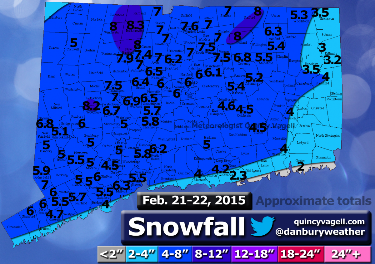
 Here is a snowfall map using reports from various sources. Many of the reports came from this forum and the National Weather Service. Only social media reports that passed through quality control were considered. All reports gathered were carefully considered and compared before being included.
Areas of weak low pressure moved through the Ohio Valley along a frontal boundary on February 21st and periods of light snow moved into Connecticut during the afternoon. The snow gradually became moderate to briefly heavy at times during the evening.
Due to the frontal boundary being west of the state, winds were generally out of the south to southwest ahead of low pressure, through the event. This led to temperatures rising into the lower 30s overnight. Snow changed to sleet, roughly as far northwest as I-84. A narrow corridor of freezing rain was reported just to the northwest of I-95. Some areas changed to plain rain south and east of I-95 along the coast and east of I-395 in far eastern Connecticut.
Precipitation changed back to snow in all areas before ending on the morning of the 22nd.
Most of the state reported a 4 to 8 inch snowfall. A few totals just over 8 inches were reported in Litchfield and Tolland counties. Snowfall totals along and southeast of the I-395 to I-95 corridor were generally in the range of 2 to 4 inches. The immediate shoreline in southeastern Connecticut reported around or just under 2 inches.
0 Comments
Recommended Comments
There are no comments to display.
Create an account or sign in to comment
You need to be a member in order to leave a comment
Create an account
Sign up for a new account in our community. It's easy!
Register a new accountSign in
Already have an account? Sign in here.
Sign In Now